For those of you that fish reservoirs, particularly the Tennessee valley lakes, there is tremendous variation between seasonal water levels. I live on Lake Cumberland in Kentucky. In 2019, for example, the low pool level was 694 feet and the high was 755. This means that at the high point, it was possible to visibly view the shoreline structure down to 60 feet deep. Now there is no question that 2019 was extreme in terms of water level, but the average is 30 feet of variation which provides ample opportunity to study the underwater topography during the winter months in anticipation of spring fishing.
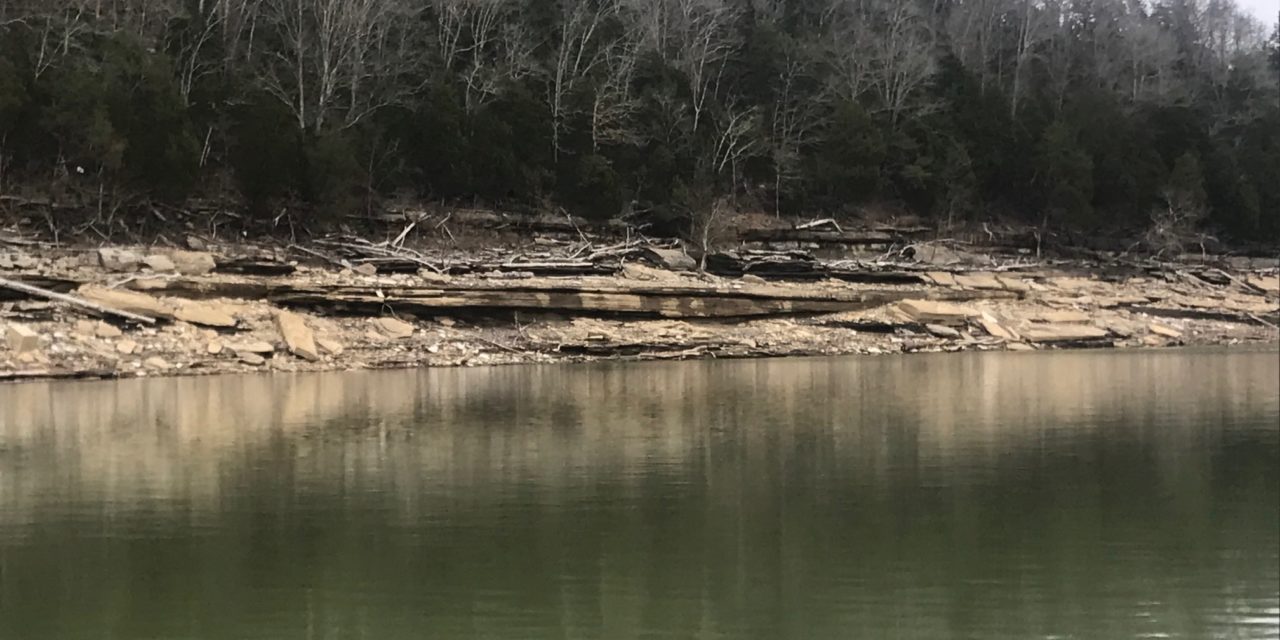
At the time of this writing, for example, the current water level is 728 feet. But I took advantage of the winter drawdown and studied the lake when the water was low. The following pictures were taken when the water level was between 710-715 feet, providing a close view of the immediate underwater structure along the shoreline.
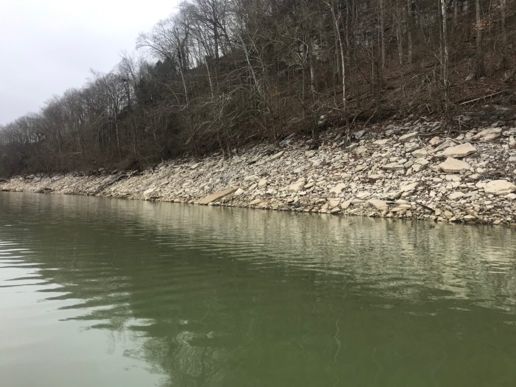
While there are a lot of glaring examples of underwater structure, I thought it would be interesting to note some of the subtelties that this approach can illuminate. Consider the picture above. This reflects the difficulty of fishing a reservoir lake. With a 1000+ miles of shoreline in a large reservoir lake, finding fish is incredible difficult, but armed with the knowledge of the shoreline composition, you can cut down the low percentage areas and focus on significant underwater variation.
While this shore is seemingly featureless, there are areas that stand out under closer scrutiny. These areas are all be for the most part hidden when the water level rises.
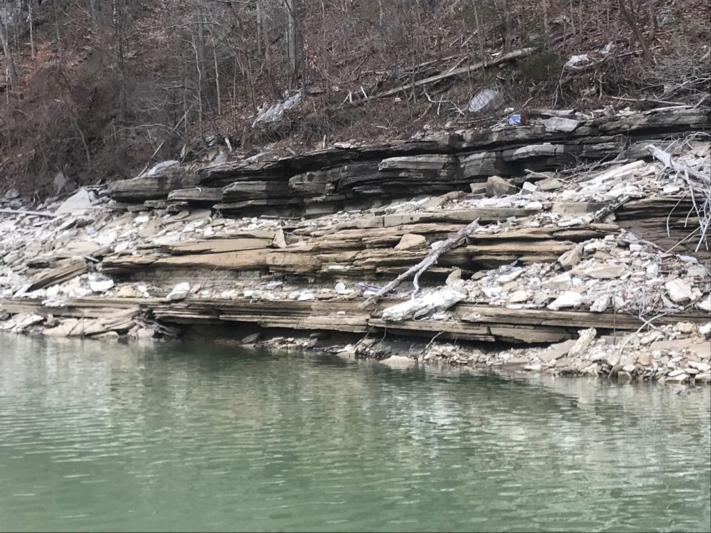
This double shelf is optimal for attracting bass. At full pool, there are three ledges that are well suited to a crank-bait approach; one shallow, one intermediate, and one deep. There might also be an opportunity to drop shot this area as well.
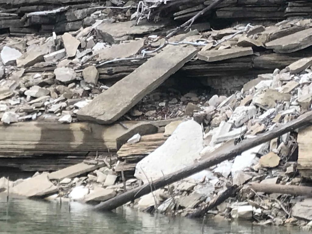
Here you can see a really intricate shoreline feature. Depending on the lake level and the weather, this is one to remember. Assuming the level is not too high, and the day is very bright, bass may likely take refuge under this rock slab.

While the base of this tree can be seen at high water, the extent of this feature is often hidden. The structure goes down 15-20 feet at high water levels. Dragging a jig or Texas rig down this structure line could be highly effective.

This is perhaps the most compelling photo I took at low level. Consider all the features in this photo. The main rock is framed by a vertical wall, a shelf, additional smaller rocks, wood, and old trees standing upright. This is not a singular feature, but rather an environment that could hold bass in one or more areas.
Taking advantage of the winter drawdown can’t guarantee success come spring, but if can provide some interesting leads on where to focus your efforts. If you live on a reservoir lake, next time the bite is lean during winter, try surveying the lake for some information that might come in handy during the spring campaign!

